Explore the Rich Mining History of Southern Oregon

By: Cate Battles / Visit Grants Pass
February 2023
When Gold Fever hit California in 1849, it wasn’t long before prospectors caught wind of Southern Oregon’s own hidden treasures. Just two years later miners discovered gold in Josephine Creek, launching Oregon’s gold rush. Thousands of prospectors with dreams of striking it rich flocked to the area, and soon, mines were producing gold along the creeks and hillsides of the Illinois, Rogue, and Applegate Valleys. Being a region rich in history, today you can still find evidence of Oregon’s golden years, from sluices and tailings in the woods, expansive gold ditches, and the remnants of boom and bust towns. Enjoy a blast from the past by following the miner’s footsteps to ghost towns, historic mining trails, and trying your hand at gold panning.
Gin Lin National Recreation Trail
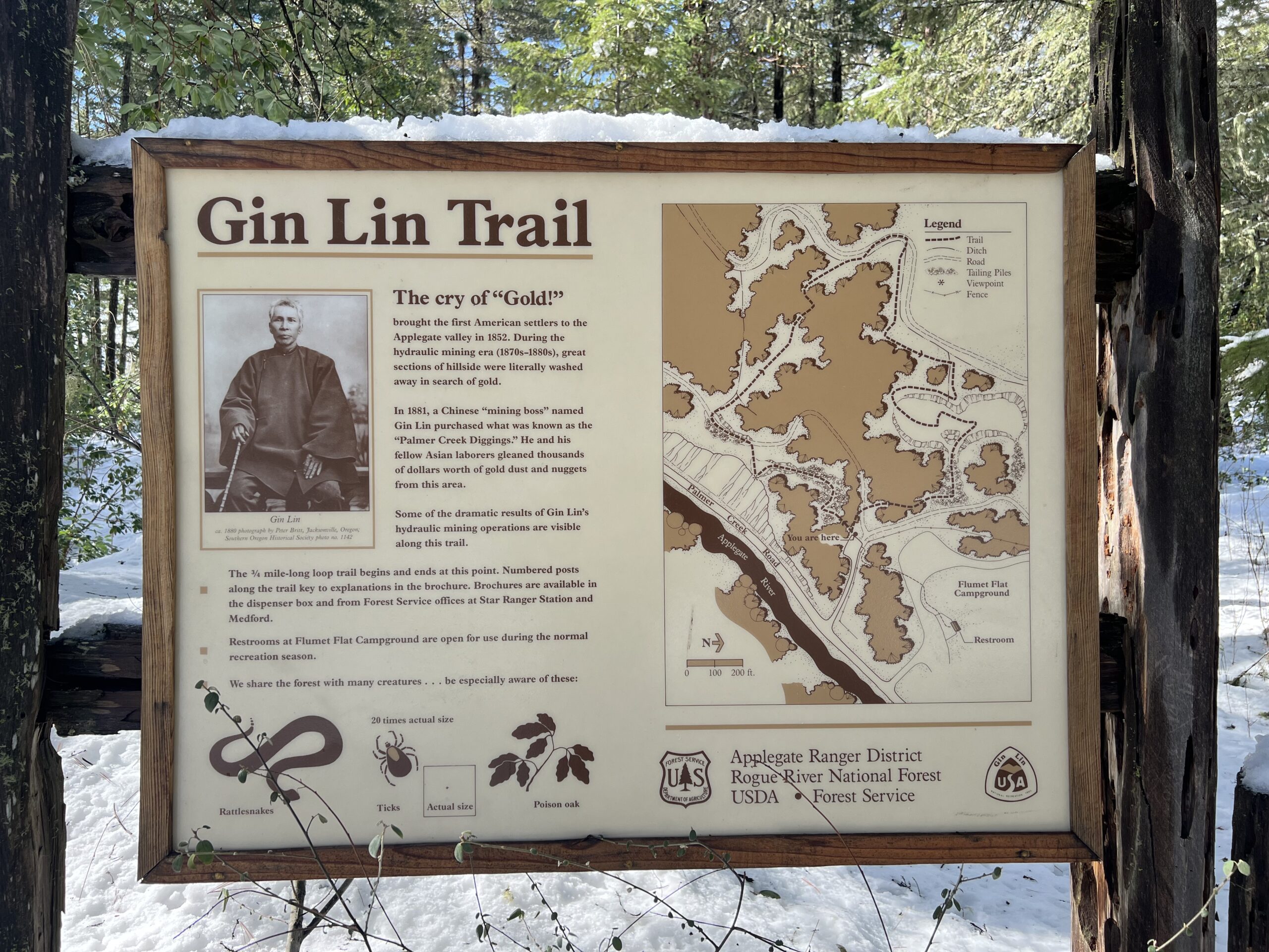
When gold was discovered in the hills, not only did it attract Americans, but fortune-seekers from around the world. In fact, nearly half of Southwestern Oregon’s miners were Chinese throughout the 1860s. News of the West’s Gold Rush reached China in the fall of 1848 and with the promise of the “golden hills” along with the social unrest in China, thousands of Chinese men left behind their wives and families and made the long journey across the Pacific. Rich claims were taken by white Americans, while poor and “picked through” ones were sold to Chinese mining operations. Despite Oregon’s exclusion laws, a mining boss named Gin Lin was able to purchase a claim on the Little Applegate near Sterling Creek in 1864. Here, he found great success which lead him to lease and purchase other “played out” placer mines in the vicinity from white miners who’d already taken out the easy gold. In 1881, he purchased the Palmer Creek Diggings in Applegate Valley, which had been worked decades earlier.
In order to extract gold from the slopes above the Applegate River, he introduced hydraulic techniques which at the time, was relatively unheard of in Southern Oregon. Hydraulic mining required a constant source of water so Gin Lin and his men dug ditches spanning dozens of miles long—- many of which can be explored today. Through hard work, ingenuity, and social prowess, Gin Lin and his mining company began to play an important role in Southern Oregon’s economy. During his time in Oregon, Gin Lin reportedly took out over $2 million in gold from his various mining claims and had an account worth over $1 million in Cornelius Beekman’s Jacksonville bank—— that’s over $30M by today’s standards!Explore the Palmer Creek Diggings site by following the .8-mile Gin Lin National Recreation Trail near Applegate Lake. The short interpretive trail offers beautiful views of the Applegate River along with piping, ditches, tailings, and evidence of hydraulic mining.

Buncom Ghost Town
Tucked away near the confluence of Sterling Creek and Little Applegate lies Buncom, an abandoned mid-19th century mining town in Southern Oregon. Founded by Chinese miners in 1851 after the discovery of gold, it was once the main supply and distribution center for farmers, loggers, ranchers, and miners in Little Applegate Valley. In its heyday, Buncom had a saloon, general store, post office and a stagecoach stop. When the gold dried up, the town persisted until the introduction of the automobile, when farmers began traveling to nearby Jacksonville for supplies. By 1920, the town of Buncom was abandoned.
After a devastating fire swept through Buncom, all but three buildings perished. Today, you can visit the post office, bunkhouse, and cookhouse, all located at the corner of Sterling Creek Rd and Little Applegate Rd. Every May, the historical society celebrates Buncom Day, an all-day affair of music, food, crafts, and a parade.
Whisky Creek Cabin
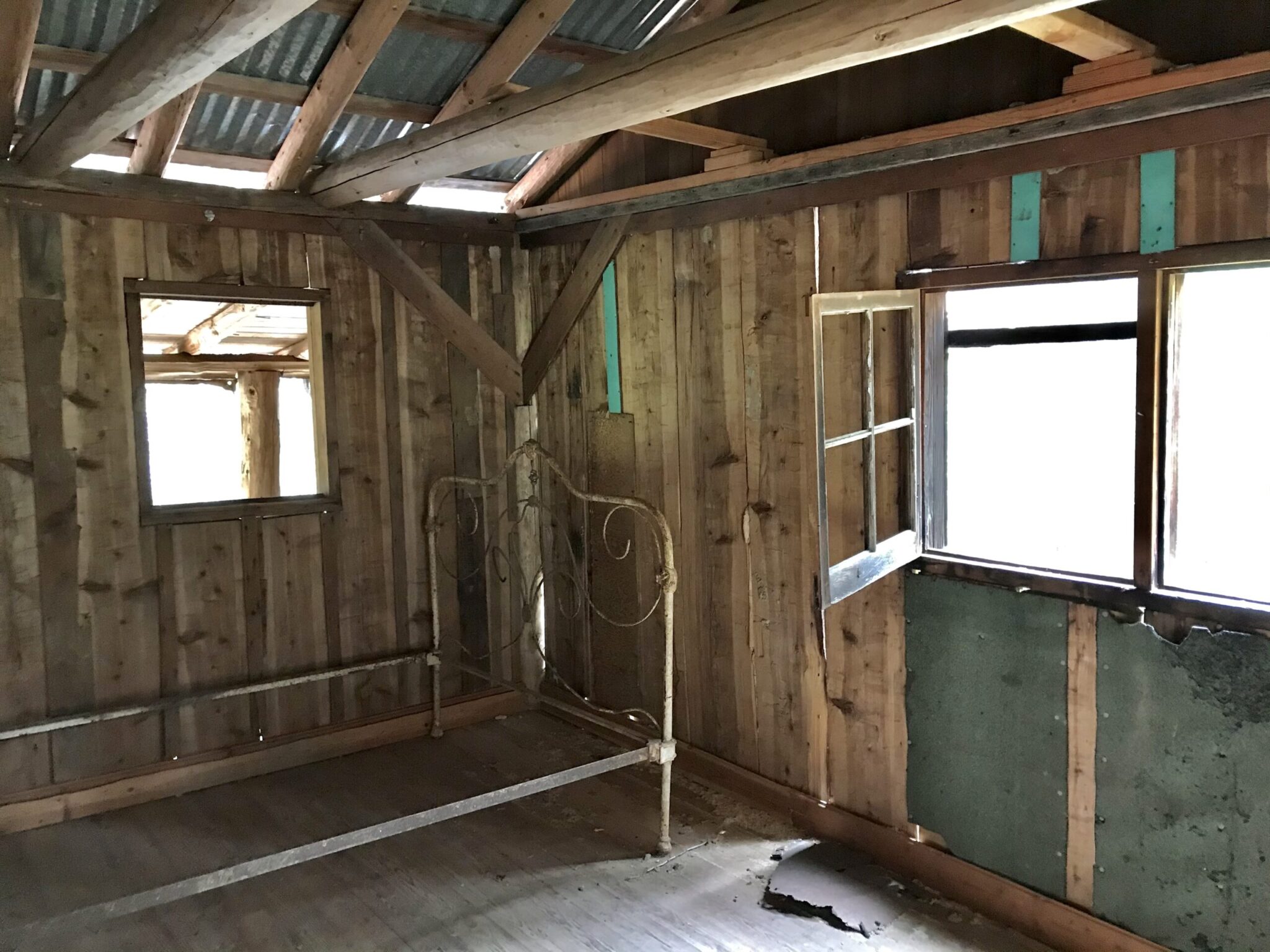
Experience one of the best day hikes in Southern Oregon by following the Rogue River Trail to Whisky Creek Cabin. This 7-mile roundtrip hike takes you to the last remaining miners cabin in the Lower Rogue Gorge and offers stunning views of the river, old-growth forest, spring wildflowers, and mining relics.
Built by an unknown miner around 1880, Whisky Creek Cabin’s original structure was very basic, consisting of four walls, a dirt floor, and a wooden shake roof. To provide water for hydraulic mining along Whisky Creek as well as drinking water to the house, a flume ditch was constructed near the cabin around 1890. Over the years the claim changed hands several times, and saw many improvements, eventually landing in the hands of L.M. Nichols and his wife who hired Lou Martin to be the property’s caretaker. Martin constructed a cable car to haul firewood across the creek. To accomplish that, he strung half-inch steel cable 480 feet across the creek, and tightened it with a system of hand-winches and pulleys. Martin remained the on-site caretaker until 1973 when the property was sold to the BLM. Due to the cabin’s isolated location, the cabin remains essentially untouched since its early days.
Today, you can make your way to this 19th century homestead by rafting along the river or hiking the Rogue River Trail from Grave Creek. During the spring and early summer, the trail is flush with wildflowers as you cross several footbridges, creeks, and waterfalls to Whisky Creek. The cabin remains open for self-guided tours where visitors can spot mining relics and interpretive signs about the area’s history. For those interested in backpacking, continue past the cabin and follow the entire 40 mile trail that stretches from Grave Creek towards the coast near Agness. At this time, the trail head is only accessible by following Wolf Creek/ Grave Creek rd as Galice Road remains closed past Rand due to the Rum Creek Fire. Despite last year’s fire, the Rogue River Trail was untouched from any damage and the Grave Creek trailhead and boat ramp remain open to hikers and boaters.
Sterling Mine Ditch Trail
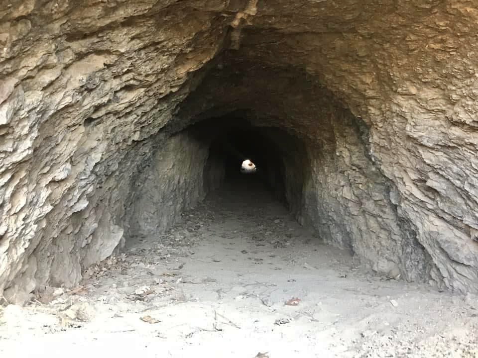
Situated near the bygone boomtown of Sterlingville, the Sterling Mine Ditch Trail showcases one of the most impressive engineering feats of Southern Oregon’s Gold Rush. After prospectors depleted the easy gold along the creek, hydraulic mining was needed to extract the gold buried in the hillsides. To supply water to the mining operation, in 1887 miners spent 6 months constructing a 26-mile ditch connecting the Little Applegate River and the Sterling Ditch Mine. The ditch was hand-dug by over 400 Chinese laborers and the 3-foot-deep ditch costed $70,000 dollars to build—- equivalent to over $2 million dollars in 2023. During its peak, the hydraulic mining operation blasted away up to 800 cubic yards of soil and rock each day, and remained in use up until the 1930s.
If you’re a hiker that enjoys history and beautiful views, the Sterling Mine Ditch Trail system is for you! Though there are 24 miles of trails in this area, a popular segment is the Tunnel Ridge/ Bear Gulch Loop that incorporates all the best qualities into one five-mile trail, with highlights including the ditch tunnel, flume remnants, panoramic vistas, old-growth trees, spring wildflowers, and a seasonal waterfall. Along Sterling Creek Road, spot the tailings and boulders left behind from the hydraulic mining.
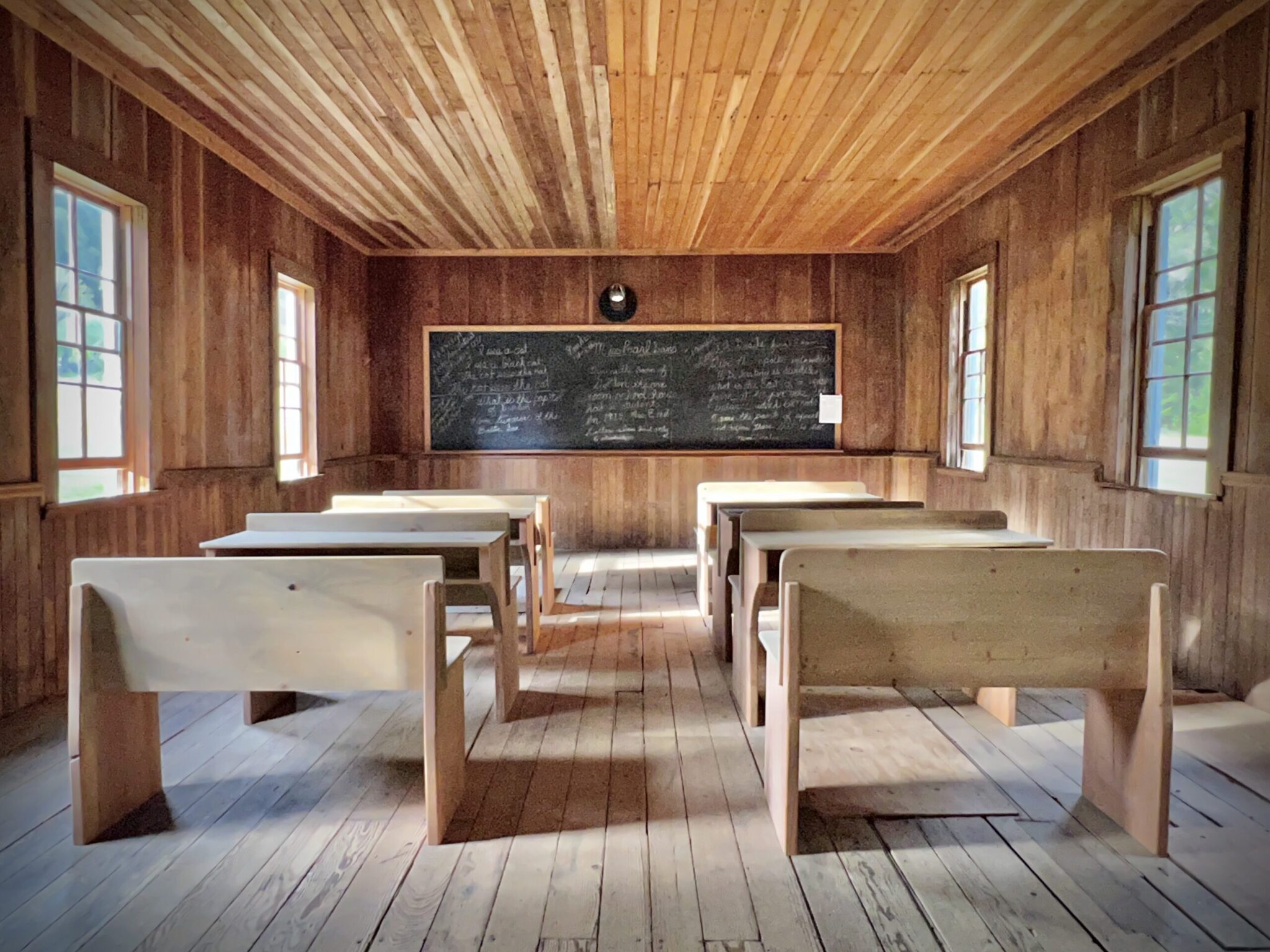
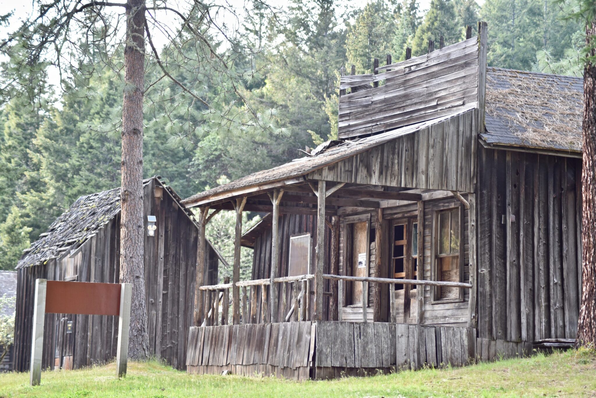
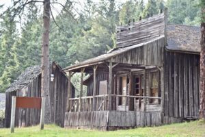
Golden Ghost Town
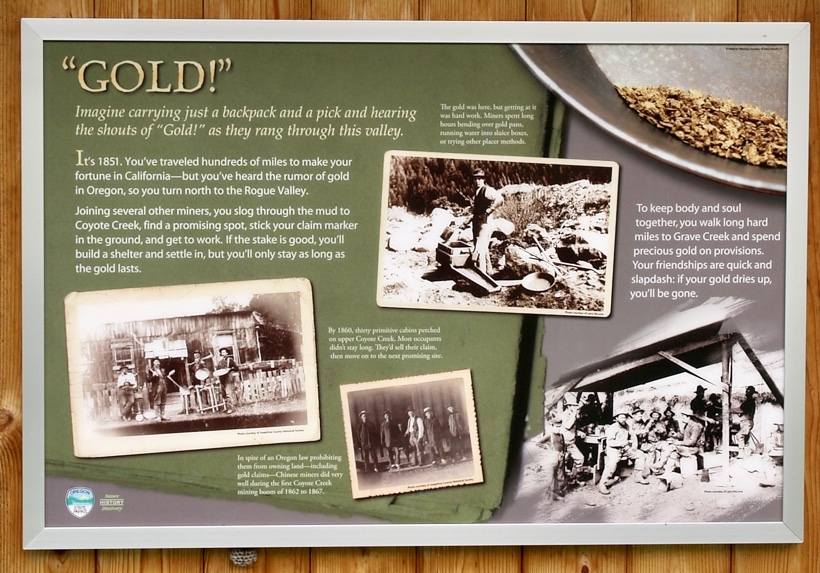
Soon after the California Gold Rush, prospectors made their way north to the Rogue Valley and laid claim to the area along Coyote Creek. After a few years, these men left for Idaho’s mining boom and more than 500 Chinese miners took their place between 1862-1872. Unfortunately for the Chinese miners, as soon as the work slowed down along Idaho’s Salmon and Snake Rivers, many of these prospectors returned to reclaim the mines and forced the Chinese out.
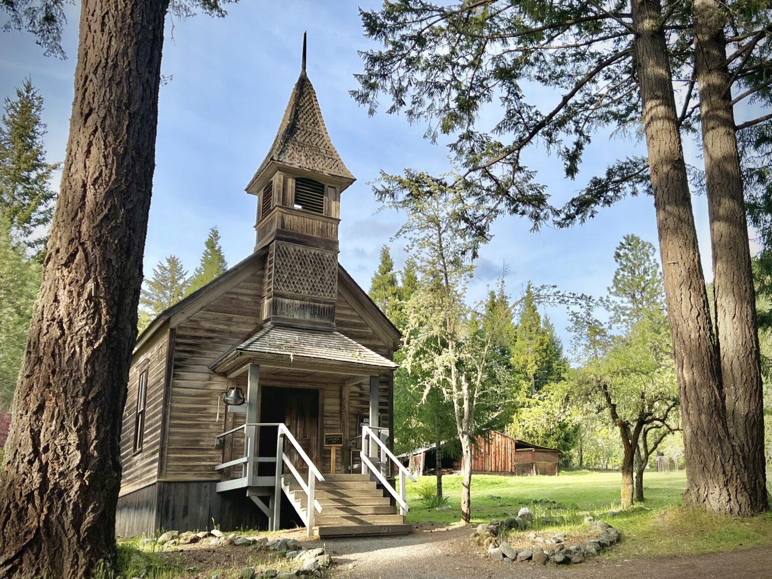
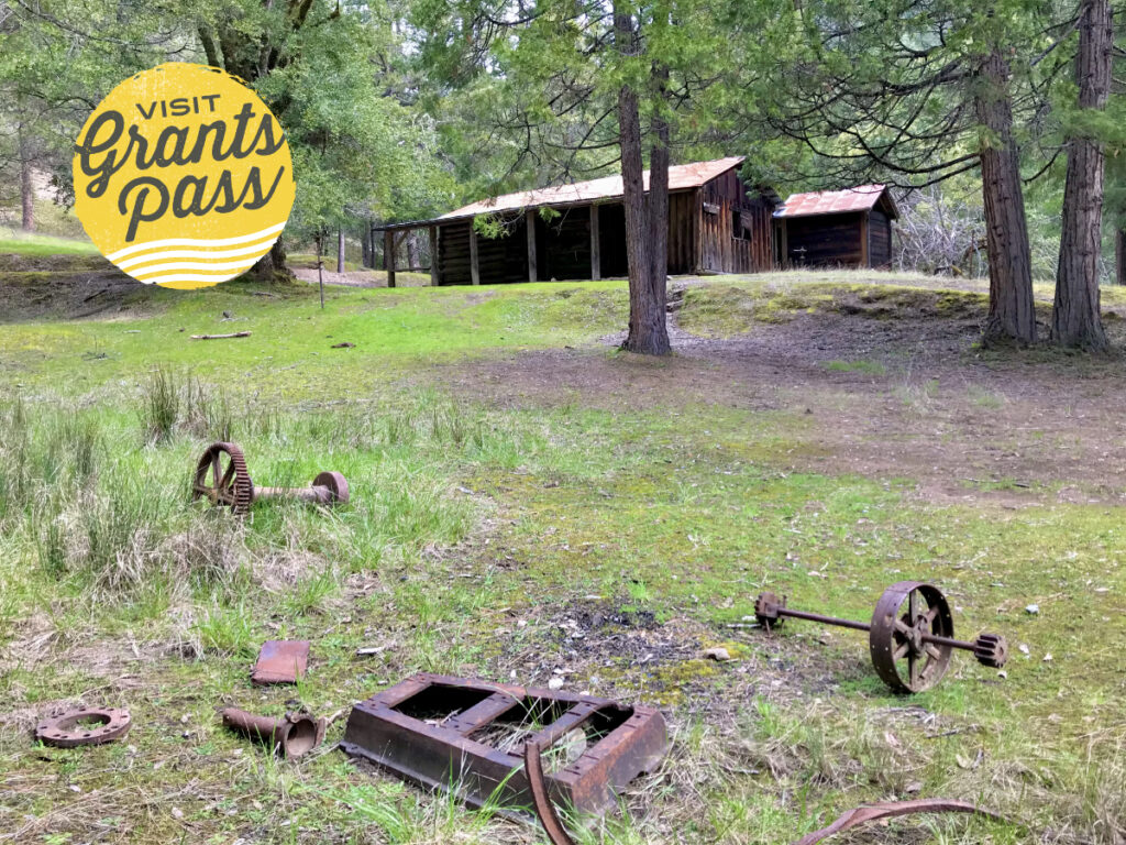
In 1880, William and Ruth Ruble along with their sons moved to Golden to seek their fortune, and eventually designed a system that made hydraulic mining more efficient with their invention, the Ruble Elevator. With the success of their new invention, the family quickly bought up land and mining rights, and the town of Golden was established in 1890. What makes this town distinguished among the rest, is the fact it had two churches and no saloons-earning its nickname as the “Driest ghost town of the West”. Founded by a religious family, the town’s thirsty miners would have to travel to the nearby Wolf Creek Inn for libations.
After the years, gold production slowed down and by the early to mid 20th century, the town was abandoned. Today, it’s a popular place for ghost hunters and has been featured on the Travel Channel’s show “Ghost Adventures”as well as Gunsmoke. Today, visitors can take a self-guided tour of the remaining church, schoolhouse, general store, and sheds. Follow the trail across the street that winds around the Coyote Creek Wetlands. Over the years, a restoration project has worked to restore the land back to its pre-hydraulic mining beauty.

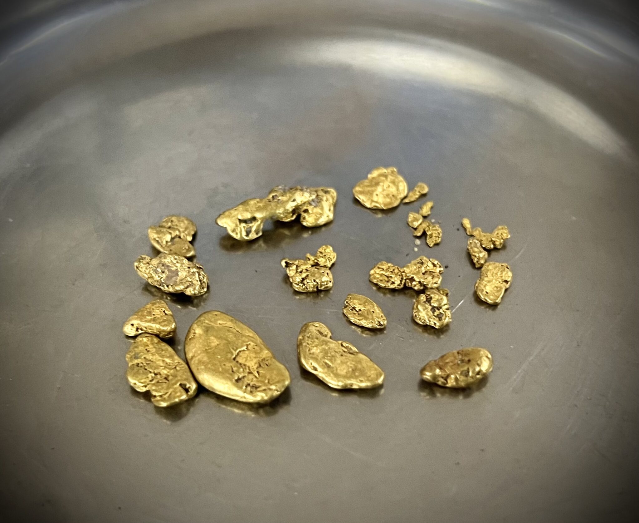
Try Your Hand at Mining
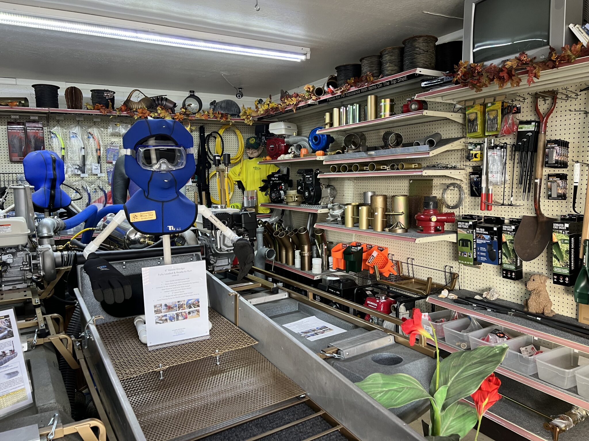
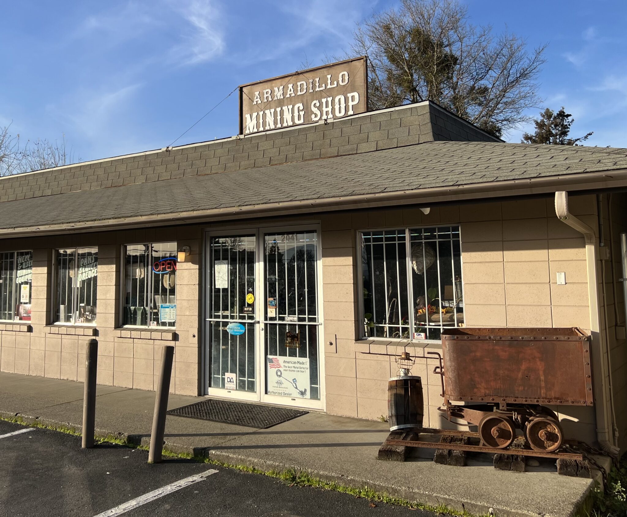
Hit the mother lode or just have fun trying by panning for gold around Grants Pass. Spend an afternoon of treasure hunting in the Applegate Ranger District and along the Rogue and Illinois Rivers—— no permit necessary!. While most National Forest and BLM land is open to recreational gold panning, it’s always best to check for other restrictions or mineral right claims. To get started, visit Armadillo Mining Company in Grants Pass where you’ll find pans, literature, metal detectors, and other tools to help you score some shiny nuggets and flakes.